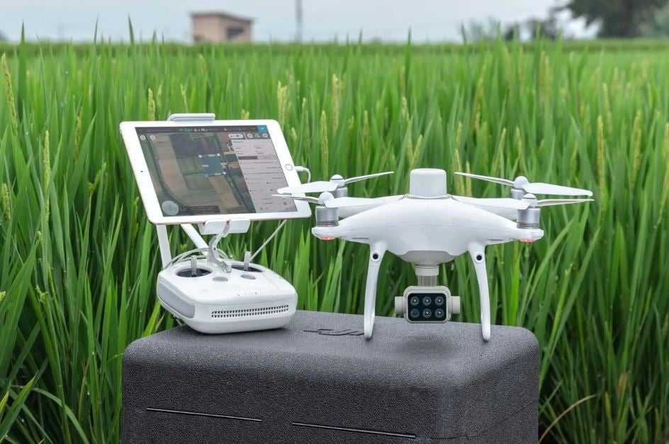
DJI has just announced the DJI Phantom 4 Multispectral drone designed as a fully integrated multispectral imaging aircraft for precision agriculture and environmental management.
Just when you thought the Phantom 4 was nearing retirement, DJI re-realses it with a brand new set of tools, breathing new life into the aircraft.
It seems that DJI is moving it's Phantom range out of the 'creative' space and into the industrial and agricultire sector, building on the integrated RTK features.
The DJI Phantom 4 Multispectral combines data from its six separate sensors to measure things like health of crops, from individual plants to entire fields, as well as weeds, insects and a variety of soil conditions.
This P4 Multispectral sets a new standard for easy-to-use agricultural drone applications.
Let's take a look at the Key Features
- Precise Multispectral Imaging
The built-in stabilised imaging system collects comprehensive sets of data right out of the box.
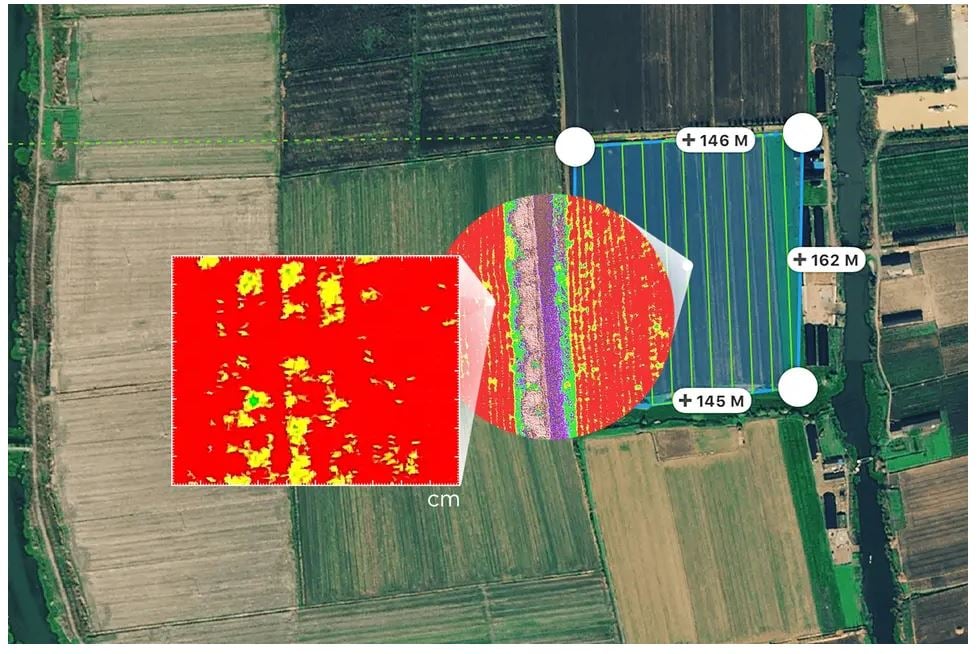
Access information collected by 1 RGB camera and a multispectral camera array with 5 cameras covering Blue, Green, Red, Red Edge, and Near Infrared bands – all at 2MP with global shutter, on a 3-axis stabilized gimbal.
- Integrated Spectral Sunlight Sensor
An integrated spectral sunlight sensor on top of the drone captures solar irradiance, which maximizes accuracy and consistency of data collection through different times of day. When combined with post-processed data, this information helps to obtain the most accurate NDVI results.
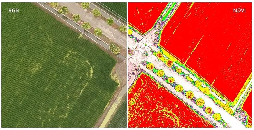
- Live RGB and NDVI View
Seamless integration into the DJI Ground Station Pro flight planning app allows pilots to switch between real-time views of the drone’s RGB video camera and Normalized Difference Vegetation Index (NDVI) output for immediate insights while in the field.
- Flight Performance
Pilots using multiple drone payloads during their operations can now calibrate the drone’s new center of gravity with ease from the DJI Pilot app for better flight performance.
- Data Accuracy
An integrated RTK positioning module and TimeSync system support real-time, accurate positioning data for each image, optimizing photogrammetric results and providing centimeter-level accurate measurements.
Compatible Software
You can use DJI Ground Station Pro to create automated and repeatable missions including flight planning, mission execution, and flight data management. Data collected can be easily imported into DJI Terra, and a suite of other third-party software.
Users can enhance the accuracy of RTK positioning without an internet connection by connecting the P4 Multispectral to the D-RTK 2 High Precision GNSS Mobile Station and NTRIP (Network Transport of RTCM via Internet Protocol)2, or store the satellite observation data to be used for Post Processed Kinematics (PPK).
You can purchase the D-RTK 2 High Precision GNSS Mobile Station with the DJI Phantom 4 Multispectral as part of a bundle deal.
How do I get one?
If you are interested in the DJI Phantom 4 Multispectral then contact the team today on 01491 526 700 or email info@flyicarus.co.uk.
We're expecting shipments of the P4 Multispectral from Mid-October 2019 and will be shipped to customers on a first-come-first-served basis. If you'd prefer to lease the aircraft, you can lease from as little as £127.05 per month.